- Who We Are
- What We Do
- Divisions
- Transparency
- News
- Events
- Regional Directory
- Careers
Serving Bastrop, Blanco, Burnet, Caldwell, Fayette, Hays, Lee, Llano, Travis, and Williamson Counties


Geographic Information Systems Planning Council (GISPC)
The GISPC was formed by the CAPCOG for coordinating and effecting the mutual development, implementation, sharing and maintenance of geospatial data and GIS applications among federal, state and regional and local governments, institutions and organizations of the 10-county CAPCOG region.
Policy & Advisory Committees
Purpose
The GISPC works to meet local and regional needs and recommendations of the Texas GISPC Statewide Geographic Information Systems Plan. The Plan calls for the formation of regional geographic coordinating councils in partnership with councils of governments in Texas. CAPCOG recognizes the need for establishing consistent GIS infrastructure and data exchange standards to assure maximum benefits of joint data development and information sharing, and will pursue the implementation of National Spatial Data Infrastructure (NSDI), Federal Geographic Data Committee (FGDC) and Texas GISPC adopted goals and standards in the region. The GISPC provides advisory support and guidance to CAPCOG administration, its Executive Committee, GIS staff, task force and committees in planning for programs or projects with GIS-related applications. Emphasis is placed on effecting the coordination, development, and implementation of cooperative programs, projects and agreements to establish GIS: communications and data exchange standards; online data services; geospatial data sharing initiatives; and global positioning systems.
Membership and Bylaws
The 17 members of the GISPC assist in the education and promotion of GIS and serve as communication links to local GIS service providers and users from their respective county and/or regional service area. In support of CAPCOG’s ongoing effort to enhance 9-1-1 Emergency Communications, members will work with county 9-1-1 GIS coordinators, database managers and members of the Capital Area Emergency Communication District’s 9-1-1 Strategic Advisory Committee to accomplish the requirements of CAPCOG/county/municipal contracts for implementation and coordination of GIS activities.
Meetings
The council conducts quarterly meetings for council business generally on the first Friday of the first month in every quarter. Special meetings can be called by the CAPCOG Executive Director, the CAPCOG council liaison, the council chair or requested in writing by at least one-third of the membership, excluding vacancies, of the GISPC. The council’s meetings are open to the public. Check the events section below for upcoming meeting details, such as time, date and location.
Related

Lee County TED seeks public input
CAPCOG will host its second community outreach meeting seeking input from residents and area stakeholders for the Lee County Transportation…Apr 9, 2024
TCEQ announces fueling facility program
The Texas Commission on Environmental Quality (TCEQ) announced that $12 million is available for projects to construct or reconstruct natural…Jan 26, 2024
General Assembly to elect Executive Committee
CAPCOG’s General Assembly will meet at 11:30 a.m. Dec. 13, 2023, at the Austin Southpark Hotel, 4140 Governors Row in…Dec 7, 2023
Aging Area plan receives abundance of community input
The Area Agency of Aging of the Capital Area, a CAPCOG division, is drafting its 2024-26 Area Plan after receiving…Jun 12, 2023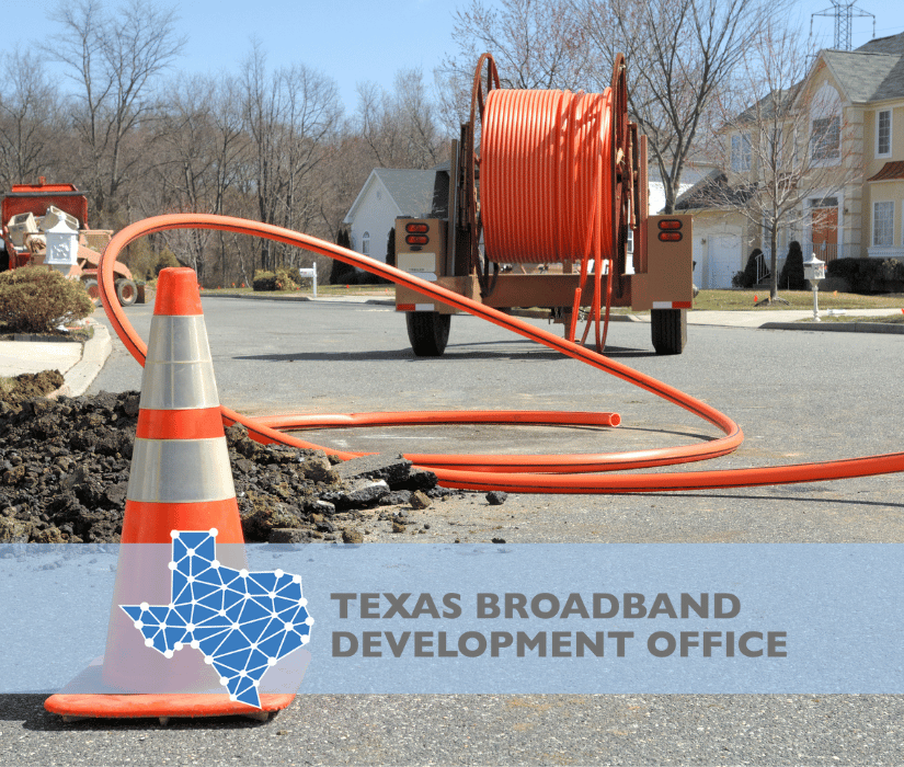
Comptroller solicits broadband infrastructure grant applications
Texas Comptroller, Glenn Hegar, announced an initial round of grants for broadband infrastructure projects with $120 million in funding available…Mar 7, 2023
Newly elected Executive Committee votes on officers
CAPCOG’s newly elected Executive Committee held its first 2023 meeting on January 11 when its members elected the board’s officers,…Jan 12, 2023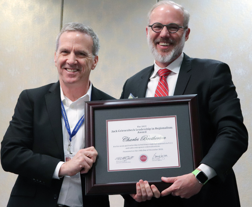
Brotherton earns regionalism award for emergency communications work
CAPCOG presented Charles Brotherton, Travis County executive of emergency services, with its Jack Griesenbeck Leadership in Regionalism Award for his…Jan 10, 2023
New training website makes registering for courses, workshops, events click
CAPCOG has modernized the navigation and added functionality features to an updated training.cacpcog.org to provide more accessible information about upcoming courses, workshops…Dec 20, 2022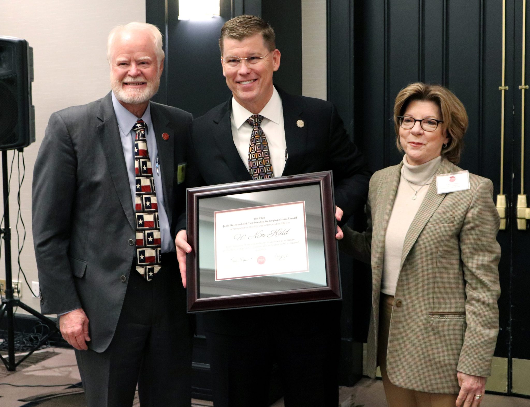
General Assembly to hear from TxDOT, elect 2023 board
CAPCOG General Assembly and the COG’s policy and advisory committee members will hear from Tucker Ferguson, TxDOT district engineer for…Nov 17, 2022
CAPCOG names Simon Regional Planning, Services director
CAPCOG has promoted Charles Simon to Regional Planning and Services director in September; he brings 34 years of local planning…Oct 25, 2022
CAPCOG readies 2023 imagery project, 2022’s goes public
Access to the newest aerial imagery could mean the difference in seeing a new road, house or neighborhood by a…Sep 27, 2022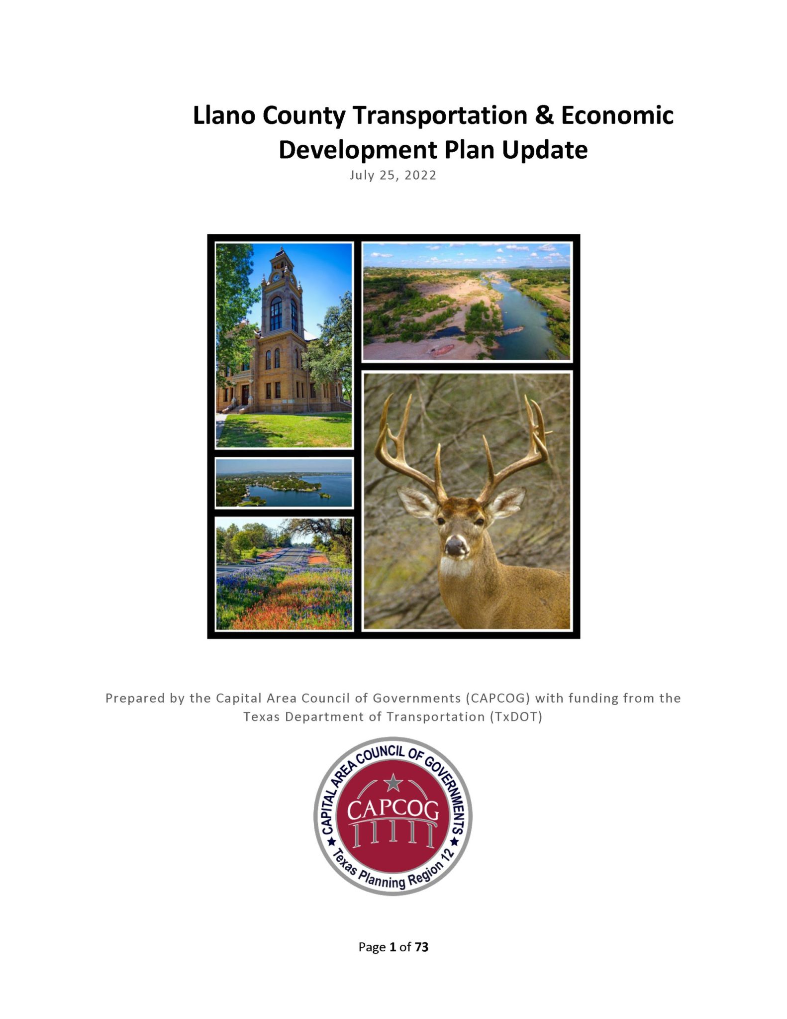
CAPCOG, Llano County complete transportation & economic development plan
CAPCOG and Llano County completed the Llano County Transportation and Economic Plan Update in August highlighting findings that illustrate unique…Sep 20, 2022
Austin Region EDA Director to speak to General Assembly
The Regional Director for the U.S. Economic Development Administration’s (EDA) Austin Regional Office, Jorge Ayala, will address the CAPCOG General…Sep 13, 2022CAPCOG General Assembly to vote on bylaws, 2023 budget
The CAPCOG General Assembly will hold its first meeting of the year at 11:30 a.m., September 14, to consider adopting…Aug 9, 2022
CAPCOG aggregates, analyzes Census estimates
Highlights from the CAPCOG’s analysis of the U.S. Census estimates for the 10-county region showed its population grew by 2.33…Jul 14, 2022
CAPCOG adds deputy executive director bringing 10 years’ government experience
Anwar Sophy joined CAPCOG as its deputy executive director in late February bringing 10 years of state and local government,…Mar 17, 2022
CAPCOG hosts Comptroller for Texas Broadband Tour
CAPCOG will be hosting the Texas Comptroller, Glenn Hegar, and the state’s new Broadband Development Office as part of its…Feb 25, 2022
U.S. Census Bureau partners with CAPCOG for census talk
CAPCOG is inviting local governments representatives including planners and GIS staff to participate in an online, January 18 meeting with…Jan 11, 2022CAPCOG, Connected Nation Texas host broadband roundtable
CAPCOG and Connected Nation Texas are hosting the newly created Texas Broadband Development Office’s (BDO) Director, Greg Conte, who will…Oct 12, 2021Census releases 2020 count, CAPCOG aggregates data
The CAPCOG region grew by more than a half million people between 2010 and 2020 according to the 2020 Census…Sep 9, 2021
General Assembly to get transportation, census update
The CAPCOG General Assembly at its September meeting will hear a regional transportation update from Tucker Ferguson, Texas Department of…Sep 7, 2021Census Bureau releases CAPCOG 2020 numbers
CAPCOG compiled population numbers from the 2020 Census at the county and regional level after the U.S. Census Bureau released…Aug 13, 2021General Assembly to elect two Executive Committee members
CAPCOG will hold a special called General Assembly meeting at 11 a.m. February 10 to elect two officials to Executive…Feb 8, 2021Executive Committee members to elect new officers at meeting
The CAPCOG Executive Committee will meet virtually for its first meeting of 2021 on January 13, when its members will…Jan 11, 2021CAPCOG General Assembly to vote on Executive Committee
The CAPCOG General Assembly will elect the 2021 Executive Committee at its annual membership meeting on Dec. 9, 2020 based…Dec 7, 2020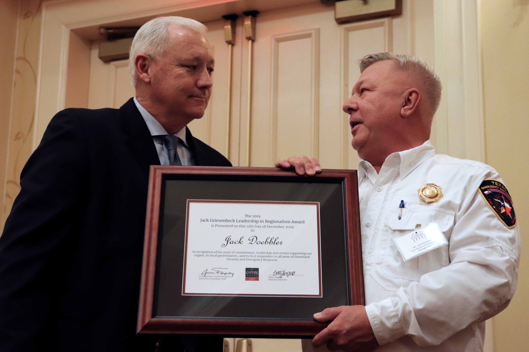
CAPCOG General Assembly to elect 2021 Executive Committee
CAPCOG General Assembly representatives will elect the agency’s 2021 Executive Committee during its 11 a.m., December 9 meeting, which will…Nov 12, 2020
CAPCOG solicits Executive Committee nominations
CAPCOG is seeking nominations from General Assembly Representatives interested in serving on the 2021 Executive Committee, which meets the second…Sep 9, 2020
CAPCOG still interested in coordinating shared services
CAPCOG sent out a survey in late January to determine if the region’s local governments would be interested in sharing…Aug 11, 2020
CAPCOG, TNRIS coordinate 2021 Aerial Imagery project
CAPCOG is seeking local jurisdictions to participate in the Texas Natural Resources Information System’s (TNRIS) Strategic Mapping Program (StratMap), so…Jul 13, 2020
CAPCOG's COVID-19 response, operations
The CAPCOG offices are currently closed to visitors because of the COVID-19 pandemic; however, all of CAPCOG's divisions are still…Jun 5, 2020
CAPCOG begins telework schedules amid COVID-19 pandemic
The Capital Area Council of Governments has moved employees to teleworking schedules beginning this week; some staff will be in…Mar 16, 2020New CAPCOG Executive Committee members elect officers
The newly elected CAPCOG Executive Committee, which conducts COG business regarding budgets, contracts, and general policies and procedures for operating…Jan 14, 2020
White gets CAPCOG Palmer award, CAPCOG gives air awards
Long-time Solid Waste Advisory Committee member, Jon White, received the 2019 Phill Palmer Volunteer Award during its annual membership meeting.…Jan 9, 2020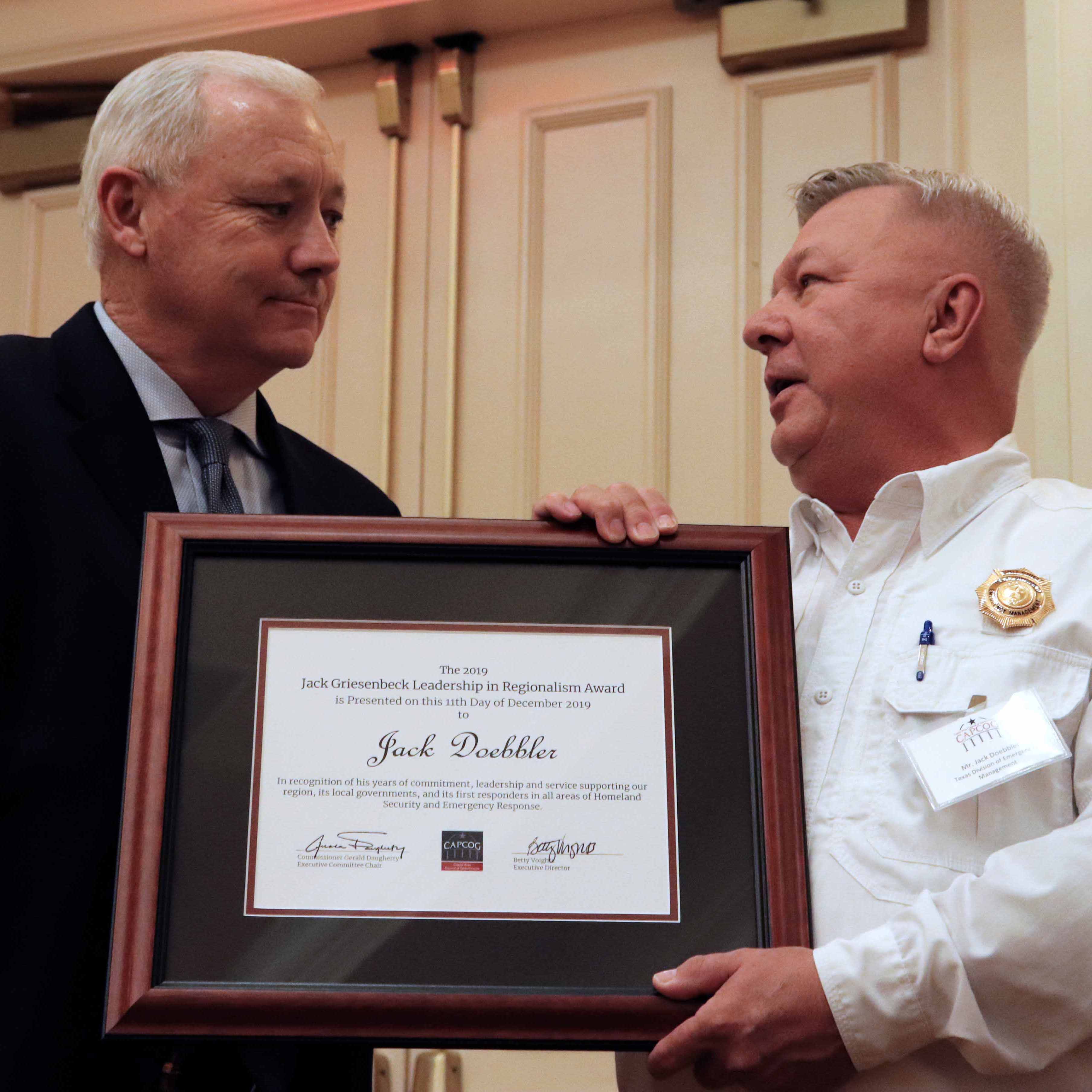
CAPCOG honors former TDEM District Coordinator for regional work
CAPCOG recognized the region’s former Texas Division of Emergency Management District Coordinator, Jack Doebbler, with its Jack Griesenbeck Leadership in…Dec 13, 2019
New CAPCOG website brings more info to members, partners
CAPCOG recently launched its new website at capcog.org to improve the organization of information, make it easier to navigate, and to update…Nov 26, 2019
General Assembly meeting to recognize regionalism efforts
CAPCOG will announce this year’s recipient of the Jack Griesenbeck Leadership in Regionalism Award along with other regional honors during…Nov 15, 2019CAPCOG taking regionalism, air quality award nominations
CAPCOG is seeking nominations for the 2019 Jack Griesenbeck Leadership in Regionalism Award, which recognizes a person whom emphasizes the…Oct 10, 2019Nominations open for CAPCOG Executive Committee board
CAPCOG will begin accepting nominations on Wednesday, Sept. 11, 2019 from eligible city and county elected officials who would like…Sep 12, 2019RPS updates CARTS Maps, adds them to myCommuteSolutions
CAPCOG’s Regional Planning and Service Division partnered with the Capital Area Rural Transit System (CARTS) to update the transportation system’s…Jul 16, 2019Flood resiliency workshop to be foundation for regional plan
The U.S. Environmental Protect Agency (EPA) and CAPCOG will conduct a Capital Area Regional Flood Management Planning Workshop that lays…Jul 9, 2019CAPCOG increases location accuracy for wireless 9-1-1 callers
The CAPCOG Emergency Communications Division has installed new RapidSOS software at nearly all the 10-county region’s public safety answering points…May 9, 2019CAPCOG calls for Orthoimagery projects, geospatial savings
CAPCOG is coordinating the purchase of geospatial data through its 2020 Capital Area Orthoimagery Project in partnership with Texas Natural…Apr 9, 2019CAPCOG upgrades 9-1-1 workstations throughout region
New workstations being installed by CAPCOG in all 31 public safety answering points (PSAPs) across the region will allow for…Mar 26, 2019